
I first started thinking seriously about Anglo-Saxon frontier landscapes in England on a dull coach trip during GCSE history. We’d been given the standard map: blue for “Anglo-Saxon kingdoms”, red for “Vikings”, a bold line for Offa’s Dyke. It all looked clear, firm, settled. The teacher talked about “the boundary between England and Wales” as if it had always existed, rulers drawing neat lines while their subjects obediently stayed on one side or the other.
Years later I ended up standing on a scruffy, overgrown stretch of what’s probably part of Offa’s Dyke near Knighton, boots caked in mud, staring at a hedge and thinking: was this really a border in any sense we’d recognise? Who actually lived here, and what did the line mean to them?
The more I’ve read, and the more I’ve walked these old earthworks, river crossings and ridgeways, the less clear that GCSE map has become. Anglo-Saxon frontier landscapes in England weren’t crisp dividing lines; they were zones of bargaining, raiding, intermarriage, gossip, and very ordinary daily work. In many ways, that messy middle ground is where early medieval England actually happened.
If you search for an early medieval map of England, you almost always get the same sort of image: coloured blocks for Northumbria, Mercia, Wessex, East Anglia, maybe Kent if the mapmaker is feeling kind. Between them, tidy borders. It looks satisfyingly clear. This king ruled here; that king ruled there.
The problem is that most of those borders weren’t tidy. Large sections were vague, argued over, or effectively shared. People paid tribute to two different overlords in the same decade. One monastery might hold land on both sides of a “border”, like the Mercian monasteries with estates deep into what we’d now call Wales, recorded in charters such as the 8th‑century document S 1257 granting land at Glasbury on the Wye.
We like to think of Mercia versus Wessex or English versus Welsh as teams with clear kits and home grounds. But when you read sources such as the Anglo‑Saxon charters, you run into mess almost immediately: disputed meadows, shared woods, cattle driven across a boundary ditch because that’s where the better grazing is.
To the Mercian king Offa, the frontier with the Welsh kingdoms might have been about tribute, prestige and military security. To a farmer in the 780s whose wheat field straddled the Wye valley, it might simply have been about which lord you paid what rent to, and how many times a year you had to turn up with a spear for someone’s quarrel.
Let’s deal with the big one: Offa’s Dyke. If you grew up in England, there’s a fair chance Offa was presented to you as the king who drew a line between England and Wales with a monumental earthwork in the late 8th century. You might have seen a diagram showing English fields on one side, Welsh mountains on the other, as if this was Mercia’s version of the Berlin Wall.
When I first walked a stretch near Montgomery, the scale did hit me. A bank up to 2.5 metres high in places, ditch on the Welsh side, running for perhaps 80 miles in surviving bits. That clearly took organisation, labour and food to feed the workers. You don’t shift that much soil for fun.
But here’s where the simple story begins to crack:
Archaeologist Keith Ray and others have argued that, in some stretches, it functions less as a hard frontier and more as what we’d now call a “controlled zone”. You can cross it on foot in seconds. If you imagine a Welsh cattle raider in 780, the Dyke is annoying, but hardly an impassable military barrier. You can drive animals through gaps and wooded sections quite easily.
So what did it do, on a human level? For someone living in a small settlement near the Dyke:
In that sense, it feels closer to a toll barrier, a marker of where Mercian authority wanted to be recognised, than a modern border. A statement in soil saying: “Beyond here, you deal with someone else.”
Offa’s Dyke hogs the attention, but it’s only one of a chain of big earthworks that shaped Anglo-Saxon frontier landscapes in England. There’s Wat’s Dyke, probably 8th or early 9th century, running a bit to the east. There are the Cambridgeshire dykes – Fleam Dyke, Devil’s Dyke, Bran Ditch – slicing across the chalk to control movement between the Icknield Way and the Fens. In Yorkshire, there’s the so‑called “Roman Ridge”, reused and reinterpreted repeatedly.
Most of these are now footpaths or rough banks by the edges of fields. But in their heyday, they would have been bright scars on the ground. Imagine walking with your children to a seasonal market and having to pass along a narrow gate through a bank and ditch, with some local strongman’s people watching you go by. The line in the soil changes how you feel about the space. You are on someone else’s terms for a while.
There’s a foreshadowing here of later border habits. Think of Harriet Martineau writing about the Scottish Borders in the 19th century, mentioning how people still told stories of “the other side” as wild or treacherous. The same mental habit probably existed in the 8th or 9th centuries on the Mercian–Welsh frontier, or along the lines between Northumbria and its neighbours. The ditch isn’t that deep, but in your head it’s full of danger.
And again, ordinary life carries on across it. A woman in a small hamlet near Devil’s Dyke in the early 7th century probably worried more about the reliability of the harvest or the health of her children than which king claimed her field. Yet that same line could suddenly become lethal if two rulers fell out and started burning each other’s border villages.
Another frontier you often meet in textbooks is the Danelaw boundary: that famous supposed line running up the old Roman road of Watling Street (roughly from London to Chester), often presented as the split between “Viking England” and “English England” around the late 9th century.
The Anglo-Saxon Chronicle even gives something like a treaty – the agreement between Alfred of Wessex and Guthrum the Dane – defining which towns lie on which side. It all sounds formal and clear-cut. When I first read it, I pictured a solid cultural border, with Norse language and customs neatly separated from West Saxon ones.
Then you start looking at places where the frontier supposedly ran: areas around Bedford, Hertford, and up through the East Midlands. Here we have place‑name studies (Key to English Place‑Names is excellent for this) showing Old Norse and Old English names tangled together. A village with a Norse name next to a wood with a Saxon one; a farm called something like “Grim’s farm” (Norse god) right by a stream with a purely English name.
On the ground, that “line” looks more like a zone of bilingual labourers, mixed families, and small landowners trying to guess which lord to back. A tenant on an estate near Northampton in 890 might have an English‑speaking mother and a Danish‑speaking father, owe military service in the local fyrd, and still brew ale with herbs her grandmother had used decades earlier in a different kingdom altogether.
The treaty line influences taxation, legal custom and who calls up whom for war. But for the teenager helping to plough a strip field, frontier reality is more pedestrian: new words for tools and days of the week creeping into your vocabulary, different coinage in local markets, disputes heard at a different sort of court.
There’s another kind of border we often ignore: internal frontiers. Even if we stay inside Anglo-Saxon frontier landscapes in England, the countryside was shot through with smaller dividing lines that mattered at least as much as the grand kingdom borders.
Parish boundaries came later, but earlier we find royal estates, hundreds (administrative districts) and the territories of local elites. A charter from King Edgar in 972 (known as S 765) carefully describes the bounds of an estate at Lyminge in Kent: “from the old ash tree to the stream, along the stream to the thorn bush…” The wording may sound dull, but those boundaries meant everything for the people who worked that land.
A family living on an estate boundary had to keep track of overlapping obligations. Harvest-week might mean working your own strips, then doing boon work on the lord’s demesne, then helping mend a boundary ditch to settle a quarrel with the next estate. If the lord lost royal favour, that tiny border could be redrawn overhead in a royal hall miles away, with huge consequences for the rents you owe.
And then there were the frontiers between cultivated land and “waste”: marsh, heath, woodland. The Fens in the early medieval period were a classic example. To a royal official, they were vaguely defined backwaters on the edge of power-blocks like East Anglia or Mercia. To the communities living in places like Ely or Crowland, they were home, with a very fine‑grained mental map of ditches, causeways and fish‑rich streams.
When the Vita of St Guthlac describes him in the early 8th century retreating into the Fens to become a hermit on an island that later becomes Crowland Abbey, there’s a double frontier at work: spiritual and political. Yet for the reed‑cutters and eel‑fishers working near his hermitage, that holy man on his island is also part of the normal working environment – someone you might trade with, or visit for a blessing before a risky crossing.
Another thing the official story tends to dodge is how frontiers affected people who never appear in the sources: women, children, people without land. When borders move on maps, their lives often change first.
Take a hypothetical woman living near the Welsh–Mercian frontier around 820. Her father might have been a subject of a Welsh king; by her thirties she finds herself classified as a Mercian. Her marriage options might shift – perhaps more pressure to marry a Mercian thegn than a local man from across the Dyke. If raiding intensifies, she becomes responsible for deciding how quickly to pack up small valuables when rumours of war filter through.
Children growing up on such frontiers probably pick up bilingual skills as a matter of course. Bede, writing in the 8th century, mentions that in his own northern world people might speak Latin, Old English, Irish and British Celtic. The Welsh–English frontier would have been another polyglot zone. A ten‑year‑old helping with sheep might translate between a Mercian reeve and a local British‑speaking shepherd without anyone writing this down, because nobody at the time thought it noteworthy.
Yet these are the people who actually made frontier areas work. Markets in border towns like Shrewsbury or Stamford relied on people who were comfortable crossing linguistic and legal divides: women trading surplus cloth, drovers knowing which tolls to pay in which jurisdiction, craftsmen moving with their tools to wherever a new church or fortified burh was being built.
The chroniclers didn’t care about their names. We should.
The first time I saw the line of the old Wansdyke in Wiltshire I nearly missed it. On a modern OS map it appears as a vague green squiggle; on the ground it’s an overgrown bank with a ditch. But as you walk along the ridge and realise it once marked a defended frontier for people in the 5th or 6th centuries – perhaps between British and incoming Germanic groups – the textbooks start to feel thin.
Here’s what hit me: from up on that bank you can see for miles. You can also hear anyone approaching long before you see them, the wind carrying sounds along the slope. If you’re a teenager on watch duty there in, say, 520, you might pass the time swapping stories about strange raiders or ghostly lights. The line in the earth shapes your imagination as well as your defence plan.
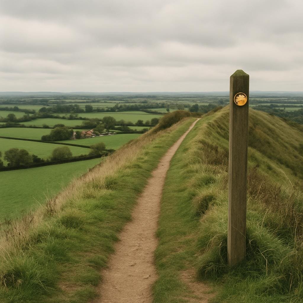
This, I think, is why modern heritage routes like the Offa’s Dyke Path matter. Not because they’re leisure trails, but because walking them reminds you that these frontiers weren’t abstract. They were muddy, noisy, physical spaces full of very ordinary worries – sore feet, bad weather, whether the sheep have wandered off again – layered on top of bigger anxieties about allegiance and survival.
Anglo-Saxon frontier landscapes in England can seem remote. But the habits formed there – of drawing lines, patrolling them, telling stories about the people “over there” – echo forward. Later conflicts on the Anglo‑Welsh border, the English–Scottish frontier, even the cultural divide between “north” and “south” in England, borrow some of their logic from these early border zones.
They also challenge some modern assumptions. We like to think national borders are old, natural, somehow inevitable. Spend time with the sources on the Anglo‑Saxon period and that view falls apart very quickly. The frontier between Mercia and the Welsh kingdoms differed in purpose and texture from the shifting edge of the Danelaw, which in turn differed from the shadowy early frontiers between post‑Roman British polities and incoming settlers.
Most of all, these spaces remind us that neat maps lie. A crisp black line on paper often hides hundreds of tiny negotiations and quiet compromises. The farming couple who agree that the boundary between their strips will be the crooked willow. The local priest who decides which saint’s cult might appeal to both communities. The woman in a border village who learns to swear convincingly in two languages so she can haggle fairly in the market.
Every time I go back to this subject, my picture of early medieval England gets less tidy and more human. Anglo-Saxon frontier landscapes in England were not the empty margins between “real” kingdoms. They were lived-in spaces of contact, conflict and creativity. If we stop treating them as edges of the story and start treating them as central, the whole narrative of how England formed looks different: more improvised, more fragile, and much closer to lived experience.
And once you’ve seen that, it’s hard to look at any border – ancient or modern – in quite the same uncomplicated way again.