
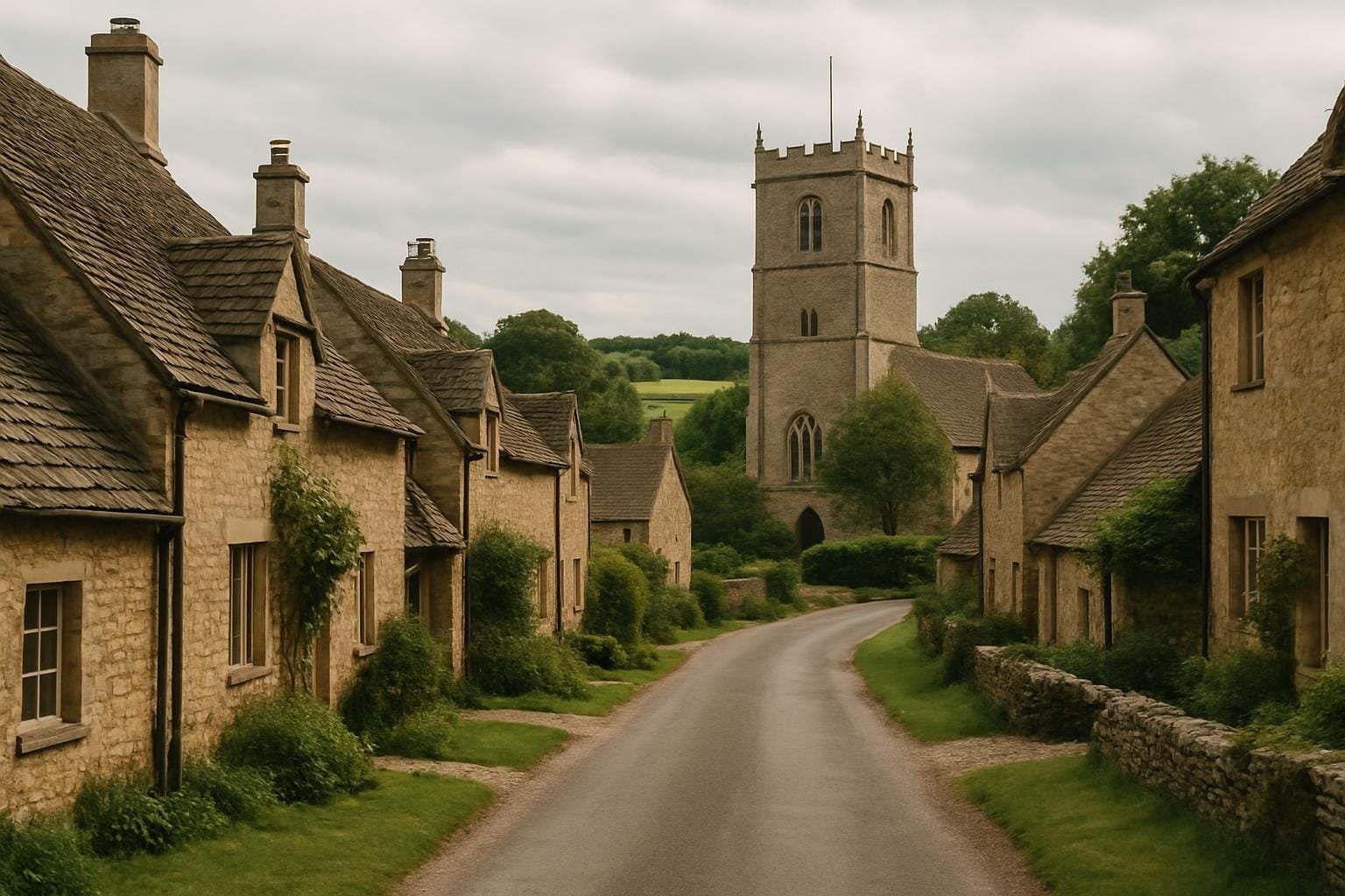
When people ask me for “Domesday Book villages to visit”, I usually disappoint them by saying something very un-touristy: the most Domesday-ish places in England often feel oddly ordinary. No tea towel stands with Norman shields, no AR app explaining William the Conqueror. Instead, you get a bend in the road, a squat church, a line of ridge and furrow on the field beyond the pub car park. And that, for me, is exactly the point.
I first met the Domesday Book in the least medieval setting imaginable: a sixth-form classroom with strip lights and a flickering overhead projector. We were told it was a “great survey”, a sort of Norman spreadsheet from 1086. The textbook gave those familiar headlines: who owned what, how many villagers, how many pigs, how efficient the Normans were at tax. It sounded grand, but it didn’t feel human. It took me years — and a few very muddy walks — to realise that quite a few English villages still map onto that survey so closely that you can more or less stand inside an entry from 1086.
A quick refresher. In 1085 William I ordered a survey of most of England (not London, not the very north, and only bits of the far west). The result, completed in 1086, is what we call the Domesday Book. It’s split into two volumes, Great Domesday and Little Domesday, written in Latin, organised by county and tenant-in-chief, and it reads like a cross between a tax return and an inventory after an estate sale.
A typical entry will say who held the land in the time of Edward the Confessor (so before 1066), who holds it now, how many villagers, smallholders and slaves there are, and what they’ve got: plough teams, mills, woodland measured by how many pigs you can feed there, that sort of thing. It often gives three values for the estate: before the Conquest, after it, and “now”.
When I first read it properly — in translation, via Open Domesday — I had that familiar student feeling: this is impressive but abstract. Then, at some point in my museum days, someone mentioned that a handful of places still match their entries almost plot for plot. Same parish boundary. Same pattern of fields. Even the same road layout. And my brain did a little jolt: so you can walk into the record?
“Domesday Book villages to visit” is a modern phrase. No one in 1086 thought of themselves as living in a “Domesday village”; they were just trying to get through the agricultural year without starving or getting fined. So when historians talk about villages that “match” the survey, we’re usually dealing with three overlapping things:
Plenty of places tick one or two of those boxes. Fewer tick all three. But when they do, something very odd happens to your sense of time. You realise that the villager listed as “Reginald, a free man” is not a ghost from a sealed-off past. He’s part of the same ongoing experiment in living on this patch of ground as the people whose wheelie bins you just walked past.
The first place where this really clicked for me was Shapwick in Dorset. I ended up there because of a book rather than a map: The Shapwick Project, an archaeological study that followed one parish from Roman times to the present. It makes heavy use of Domesday, and I remember thinking, halfway through, that this felt more like forensic work than grand narrative.
Shapwick’s Domesday entry mentions a church, a mill, meadow, pasture and a decent number of households. If you walk through the village today (as I eventually did, clutching a photocopy of the 1086 text like a very nerdy treasure map), you can match a lot of that up:
It’s one thing to read “20 villagers and 8 smallholders” in translation; it’s another to stand on that main street and imagine what that actually meant. Twenty households with enough land to farm a proper strip in the fields, eight with smaller bits, all of them dependent on the rhythm of ploughing and sowing, and all of them, in 1086, painfully aware that men with clipboards (well, wax tablets) had turned up from the king.
We don’t know what Shapwick’s people thought about being counted for Domesday, because no one asked them. The only voices we have are those of the men who held the land and the clerks writing in Latin. But we do know that by 1086 many Dorset communities had been burned or “wasted” during William’s campaigns. Domesday sometimes notes this bluntly — “waste since the king came to England” — with no extra comment, as if a ruined village were just another entry in a ledger.
That’s one of the things the neat “Normans were efficient administrators” line leaves out. The book that standard texts praise as a marvel of medieval bureaucracy is also a record of places broken by conquest, where “waste” translates into burnt timbers, dead livestock and families trying to rebuild.
To talk about the villages that still fit Domesday, you also have to talk about the ones that don’t. One of my favourite mental comparisons is between somewhere like Shapwick and Goltho in Lincolnshire.
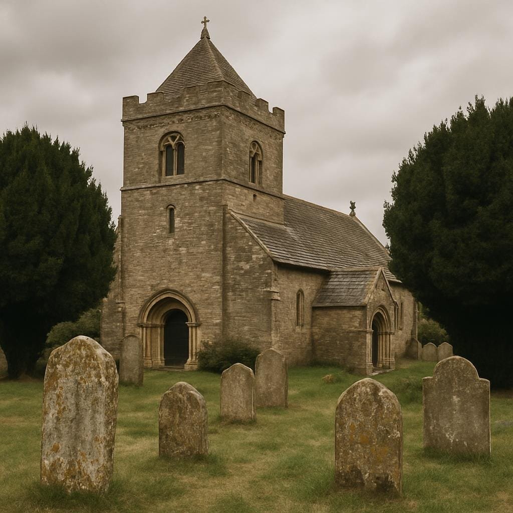
Goltho appears in Domesday with a decent entry: a hall, a church, a number of households. It had the full medieval package. Now, the medieval village is gone. What you see on the ground is the church of All Saints (now redundant and in the care of the Friends of Friendless Churches), standing alone by a lane, with earthworks of the village and manor around it.
Goltho unraveled over centuries: enclosure, changing farming practices, people drifting to towns. By the 17th or 18th century, the settlement around the church was hardly more than a memory. Domesday’s list of people — “villagers, smallholders, slaves” — has no direct descendants in the parish now, because there’s barely a parish.
Standing there, a few years back, boots squelching through the grass, I realised that the villages that still align neatly with the Domesday survey are the exception, not the rule. In a sense, Goltho is more typical: England has hundreds of deserted or shrunken medieval villages, some with lovely Domesday entries. The fact that anyone can even use a phrase like “Domesday Book villages to visit” says more about our appetite for continuity than about what actually happened to most rural communities.
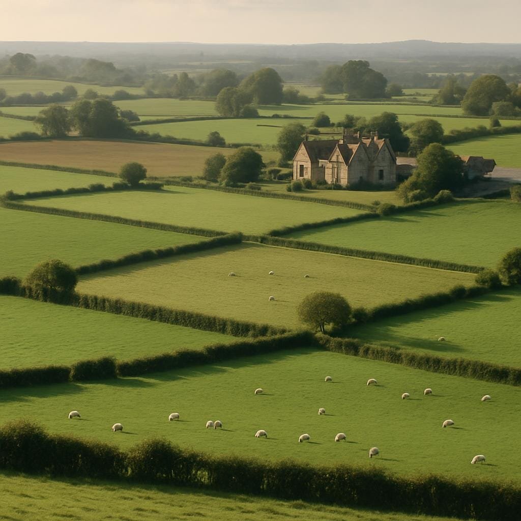
Another Dorset example shifted my thinking again: Winterborne Kingston. On the surface, it’s a straightforward Domesday link. The survey describes a reasonably sized settlement with land for ploughs, meadow and some woodland. Modern Winterborne Kingston matches the basic pattern: you can place the church, the manor site and the line of the street into that 1086 framework quite comfortably.
But recent archaeology in the fields just beyond has revealed a huge Roman-period village covering more than 25 hectares. For centuries before Domesday, people here lived in a way that never made it into the 1086 record. The survey is often sold to students as a kind of baseline for medieval England, but for Winterborne Kingston it’s more like a snapshot of one phase in a much longer story of people rearranging themselves around the same stream and the same soils.
This is where the “Domesday Book villages to visit” idea starts to look a bit shaky. The Domesday entry is a useful hook — it lets you say “something was definitely here, doing roughly this, in 1086” — but it’s never the beginning of the story, and it’s rarely the end.
Whenever I talk myself into admiring the neatness of the Domesday survey, I try to bring it back to the everyday. A few concrete bits that help:
In textbooks, Domesday tends to be framed as the foundation of royal government. Those human textures usually get boiled down to “life was hard for peasants” and left there. But the survey is full of the stuff that made up someone’s Tuesday afternoon in 1086: quires of meadow to mow, a dispute over access to the mill, the awkwardness of having your late husband’s name recorded while your own goes unmentioned.
There’s another simplification that bothers me: the idea of the Domesday Book as a great moment of English nation-building. The standard line goes something like: “William wanted to know what he owned, so he ordered this survey, which laid the foundations of English administration.”
Technically, yes. But if you anchor yourself in a single parish, that story feels upside down. Domesday didn’t create Shapwick, or Winterborne Kingston, or Goltho. It caught them mid-stride and categorised them for a newcomer king who barely spoke their language. The book wasn’t for the villages; it was for the court. When we treat it as a kind of love letter to local identity, we’re projecting backwards.
You can see this most clearly if you pick an area where the Domesday entry feels thin compared to the archaeology. The Fens are a good example, as is much of Derbyshire where I live: upland villages that later boomed with lead-mining barely register in Domesday because, in 1086, the focus was on taxable agricultural value, not future industrial potential.
The headline Domesday narrative smooths all that away. It presents the survey as a countrywide mirror, equally reflective everywhere, rather than a very particular set of questions asked from the top down.
All right, but which places might you actually go to if you want to feel that flicker of recognition between page and pavement?
There isn’t an official list of “Domesday Book villages to visit”, and that’s probably a mercy. But there are a few good candidates where you can stand in the parish and read the entry without too much imaginative stretching:
But the real trick, I think, is to stop hunting for a perfect match and start using Domesday as one layer in the way you read any village. If you’re in Derbyshire — say, in Ashbourne, which does appear in the survey — you can stand in the market place and think: in 1086 this was already a node of trade, with dues and tolls written up for some Norman lord miles away.
That’s why the phrase “Domesday Book villages to visit” is slightly misleading. The point isn’t to tick off a set of places as if you’re filling the survey back in. The point is that Domesday gives you just enough grip on 1086 to let an ordinary modern village feel suddenly crowded with extra lives.
The last time I had that sensation was closer to home, in a small Derbyshire village whose name is there in Domesday, although the entry is brief. I was walking back from the church — another Norman core under later layers — thinking about the “four villani and three bordarii” the survey allocates to the manor. Seven households. You could fit them all into one of the new-build cul-de-sacs on the edge of the parish.
I’d spent a morning in the local record office earlier that month, skimming 14th-century court rolls from the same place: a woman fined for brewing weak ale, a man in trouble for letting his pigs stray into the lord’s meadow. Between them and the anonymous seven households of 1086, you can trace a line of lives lived under almost constant supervision. Recorded about, but rarely in their own words.
That, I think, is where visiting these places actually helps. Standing in the street or by the churchyard wall, you feel the gap between the tidy Domesday summary and the messy reality: sick children, bad harvests, quarrels over hedges, someone secretly skimming grain from the mill. And you also feel how arbitrary survival is. Some villages kept their shape so well we can market them as “Domesday Book villages to visit”. Others, like Goltho, slipped mostly into earthworks and specialist books.
The Domesday surveyors thought they were writing something final — so final they nicknamed the book after the Last Judgement. “Domesday”: a record from which there could be no appeal. Nine hundred and forty years later, we use it very differently: as a slightly blurred lens through which to watch ordinary people carry on living in the same fields, on the same bends in the river, in places that don’t always feel historic enough to get their own brown sign.
Textbooks like to celebrate the survey as the moment England got counted. Standing in the villages behind those numbers, you realise how little of that counting was done from the ground up. The human detail is mostly in the gaps. But once you start looking for it — in field names, church fonts, lumpy paddocks that line up with Domesday ploughlands — you can’t quite see these places as regular villages again. They’re parishes with footnotes.
And if you do go hunting for Domesday Book villages to visit, the best preparation isn’t a heritage trail leaflet. It’s ten quiet minutes with the entry on Open Domesday, followed by a walk with muddy shoes and an eye for small things: a surviving strip of ridge and furrow, an oddly wide verge where a green once was, a lane that clearly predates the cars on it. History shrinks, nicely, from a national survey to the level of who walked this way in 1086 and hoped the clerk got their lord’s name right.